

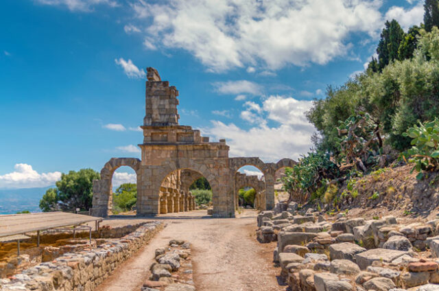
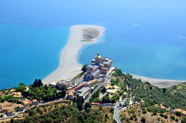
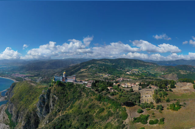
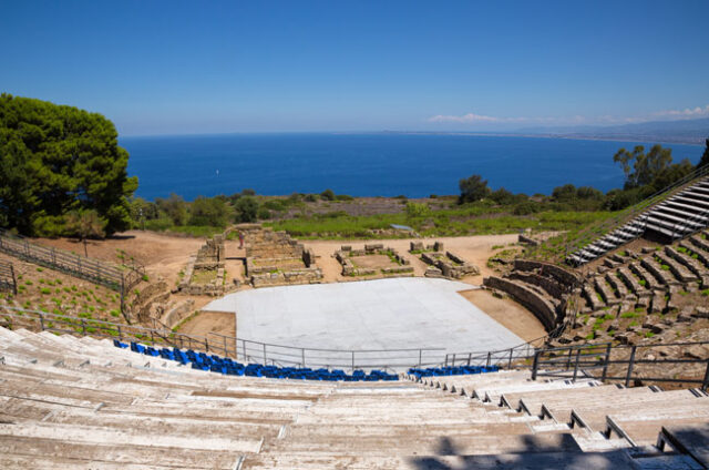
Tindari is located on a coastal promontory that juts out, from a height of 268 m, overlooking the Tyrrhenian Sea and the Oriented Natural Reserve of the Marinello lakes. The reserve at the foot of the promontory is connected to the sacred area and the archaeological park by the path called Coda di Volpe.
Coda di Volpe
The path with its path connects the Oriented Natural Reserve of the Marinello Lakes and the entire port area of Oliveri to the ancient city of Tindarys, a stretch that was subsequently used as a pilgrimage route to the Marian shrine. The particular altimetric conformation with intermediate saddle recalls the typical development of the caudal extremity of the fox. Hence the etymology Coda di Volpe (local dialect “cuda vuppi” or “â cuda â vuppi”).
The path that at times crosses or delimits areas cultivated with olive groves, is characterized by Mediterranean scrub, offers spectacular landscapes of the Gulf of Patti, enchanting views of the Aeolian Islands, a breathtaking view of the Peloritani chain and the Milazzo peninsula, sweeps over the area port of Oliveri and offers a unique scenario of the Marinello lagoon system.
The route begins in the valley in the Marinello accommodation area, passing through the underpass the historic route of the Messina-Palermo railway, the carriageways of the A20 motorway on the west side near the service areas, the signs on the left indicate the start of the itinerary entirely detached and partly paved in the first section. In about two hours, after two slight ups and downs, reaching the altitude of 283 meters, you reach the service areas located on the precipice behind the entire complex used as a sanctuary, end of the path upstream.